![]()
Earlier attempts to redesign the Mercator map |
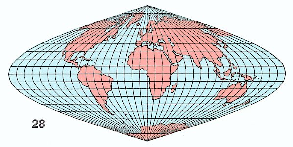 Fig. 28 1650: The Sanson Projection. Developed by the French cartographer Nicolas Sanson from sketches left by Mercator. The onion-shaped map has area fidelity. The countries and continents outside the equatorial zone are badly distorted. The abandonment of a rectangular shape led to loss of perpendicular representation of north and south. |
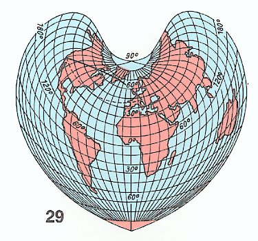
Fig. 29 1752: The Bonne Projection. The French cartographer Rigobert Bonne created this heart-shaped map. His projection has area fidelity but the map has a confusing medly of the points of the compass. North lies to the top right in one position but to the bottom left in another. The shapes of the continents away from the map centre are heavity distorted. |
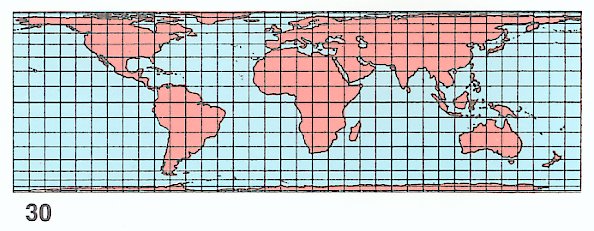 Fig. 30 1772: The Lambert Projection. The German cartographer Johann Heinrich Lambert recognised that the rectangular shape of Mercator‘s map had to be retained. He created the first global map on which fidelity of area and a rectangular grid System were unified. This advantage was outweighed by the “towel format“ (height : width = 1:3) and the distortion of Europe. |
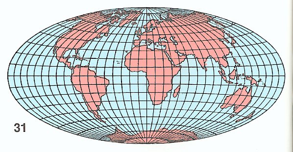 Fig. 31 1892: The Hammer Projection. The German cartographer Ernst Hammer created this oval map of the earth which has area fidelity. By sacrificing rectangular format the perpendicular north south axis was also lost. Curvature of the latitudonal rings led to loss of the horizontal east west axis. Shapes of countries outside Europe and Africa are heavily distorted. |
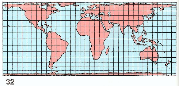 Fig. 32 1910: The Behrmann Projection. The German geographer started out accepting the inevitability of the rectangular shape of a map of the world and thus retained the correct north-south and east-west axes. His map had area fidelity but the “towel format“ (height : width 1:2.5) led to strong distortion of European countries. |
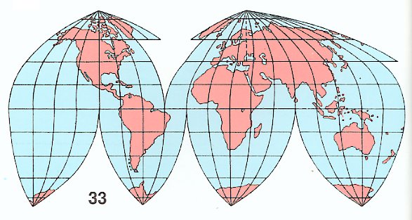 Fig. 33 1923: The Goode Projection. The north American cartographer J. Paul Goode combined fidelity of area with greatest possible fidelity of shape even in those areas of Europe and North America far from the equator. To achieve this he sacrificed the compactness of the map. Antarctica was divided over four peaks of the map. The north-south axis has been totally lost. |
![]()
Please report all broken LINKS, thank you.
This is a private homepage with absolutely no commercial intentions.
Copyright © Jürgen Heyn 2001, All rights reserved
Date of last amendment: 21. Januar 2001