| Wählen Sie die deutsche Sprache |
| Wählen Sie die deutsche Sprache |
Each time has its own geographical view of the world ...
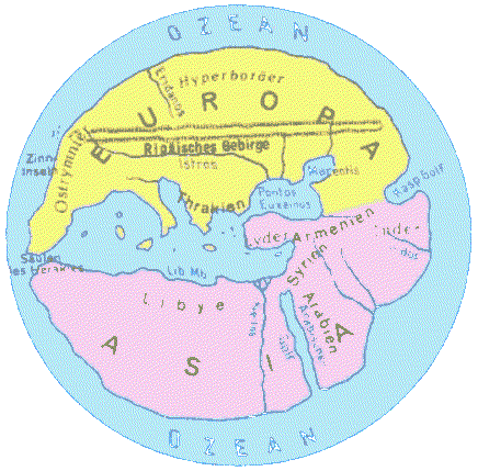
THE GREEK HEKATAIOS produced, some 2,500 years ago, a map of the world with the three continents Europe, Asia, and Libya (= Africa). In the centre is his birthplace Milet (Asia Minor).
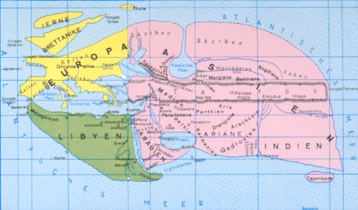
THE GREEK ERATOSTHENES drew, 2,200 years ago, a
map of the world covering Ireland and the British Isle as weil as India down to the
Ganges. Calculated the earth‘s circumference almost exactly with 39,816 km. Placed
the centre of Hellenistic blending of Greek and Asiatic civilizations (Media) in the
centre of world map.
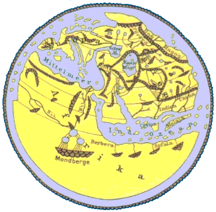
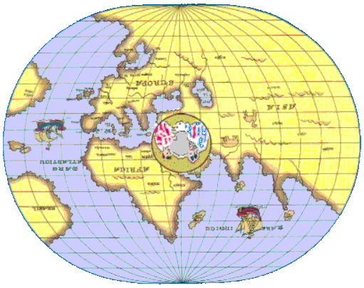
THE ARAB AL IDR1SI drew, 800 years ago, his map of the world on a silver disc, two meters in diameter. In the centre he placed Mecca, birthplace of Mohammed. Produced an atlas with 71 maps.
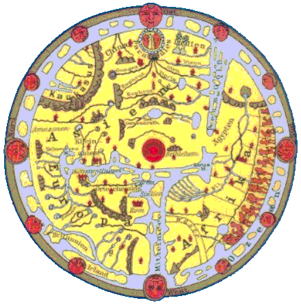
THE ROMAN CATHOLIC CHURCH propagated for about 750 years a Christian view of the world with Jerusalem and Bethlehem as centres. Above the ‘London Psalter-map‘, dating from the 13th century.
THE ITALIAN HIERONYMUS MARINI stuck, as late as
1512, still to the Christian view with Jerusalem as the centre of a
new, more widely known world after the discovery of America.
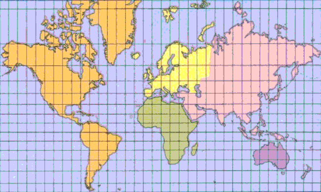
THE GERMAN EDUARD KREMER (MERCATOR) produced 1569 the first exactly calculated map of the world, replacing by it the unscientific Christian geographic view of the world. His map, though often improved, shows, even in the modern form presented above, an unrealistically enlarged Europe as centre of the world.
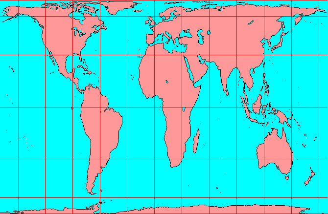
Distortion of area in Mercator's map
The earliest maps showed the immediate surroundings of the place where they were produced. The spirit of research spread over always widening surroundings, equally in all directions of the heavens. Thus, the native place remained always in the centre of a constantly widening geographic world-view.
Soon after the beginning of the Christian era this naive self-centredness of the world-view was replaced by a very conscious placing of one‘s own living space in the centre.
The latest expression of such an ideological geography is Mercator‘s world-map, still in common use today. But its distortion of proportions in favour of Europe and the northern third of the globe inhabited by the ‘white man‘ has now become untenable. Our scientific age requires an objective map of the world on which all the world‘s countries are represented in a way that does justice to their factual size and situation.
... our time has produced the Peters-Map.
Please report all broken LINKS, thank you.
This is a private homepage with absolutely no commercial intentions.
Copyright © Jürgen Heyn 2001, All rights reserved
Date of last amendment: 26. Februar 2001